
Greene County ZIP Code Crosswalk
The Missouri ZIP and city dataset returned the following Greene County rows on August 27, 2026. This is a state crosswalk, not a map of delivery boundaries, city limits, neighborhoods, or residents. It does not say that a ZIP lies wholly inside Greene County, and it does not identify a post office for each row. The table preserves the documented rows rather than filling gaps with claims the snapshot does not make.
| ZIP | City row in state snapshot | Post Office | Snapshot note |
|---|---|---|---|
| 65604 | Ash Grove | Not identified in snapshot | ZIP/city row |
| 65612 | Bois D’Arc | Not identified in snapshot | ZIP/city row |
| 65619 | Battlefield | Not identified in snapshot | Shared ZIP/city row |
| 65619 | Brookline Station | Not identified in snapshot | Shared ZIP/city row |
| 65648 | Fair Grove | Not identified in snapshot | ZIP/city row |
| 65725 | Pleasant Hope | Not identified in snapshot | ZIP/city row |
| 65738 | Republic | Not identified in snapshot | ZIP/city row |
| 65757 | Strafford | Not identified in snapshot | ZIP/city row |
| 65765 | Turners | Not identified in snapshot | ZIP/city row |
| 65770 | Walnut Grove | Not identified in snapshot | ZIP/city row |
| 65781 | Willard | Not identified in snapshot | ZIP/city row |
| 65801 | Springfield | Not identified in snapshot | ZIP/city row |
| 65802 | Springfield | Not identified in snapshot | ZIP/city row |
| 65803 | Springfield | Not identified in snapshot | ZIP/city row |
| 65804 | Springfield | Not identified in snapshot | ZIP/city row |
| 65805 | Springfield | Not identified in snapshot | ZIP/city row |
| 65806 | Springfield | Not identified in snapshot | ZIP/city row |
| 65807 | Springfield | Not identified in snapshot | ZIP/city row |
| 65808 | Springfield | Not identified in snapshot | ZIP/city row |
| 65809 | Springfield | Not identified in snapshot | ZIP/city row |
| 65810 | Springfield | Not identified in snapshot | ZIP/city row |
| 65814 | Springfield | Not identified in snapshot | ZIP/city row |
| 65817 | Springfield | Not identified in snapshot | ZIP/city row |
| 65890 | Springfield | Not identified in snapshot | ZIP/city row |
| 65898 | Springfield | Not identified in snapshot | ZIP/city row |
| 65899 | Springfield | Not identified in snapshot | ZIP/city row |
The duplicated 65619 rows for Battlefield and Brookline Station are the clearest local reminder that a ZIP can relate to more than one named place. The many Springfield rows should not be relabeled as neighborhoods. The inspected dataset does not classify any row as standard delivery, PO Box, or unique-use, so exact mailing questions belong with USPS.
Greene County ZIP Code Limits
The state data portal supplies a useful starting list, not a complete postal atlas. It does not provide ZIP-level population, ZIP+4 ranges, post-office hours, city-by-city boundary polygons, or a resident list. Postal practice can include standard, PO Box, and unique-use patterns, but the inspected Greene County data did not classify individual rows. A careful postal crosswalk labels the source and date, then avoids turning a city row into a delivery claim.
The official Missouri dataset result displays the ZIP and city crosswalk used here.
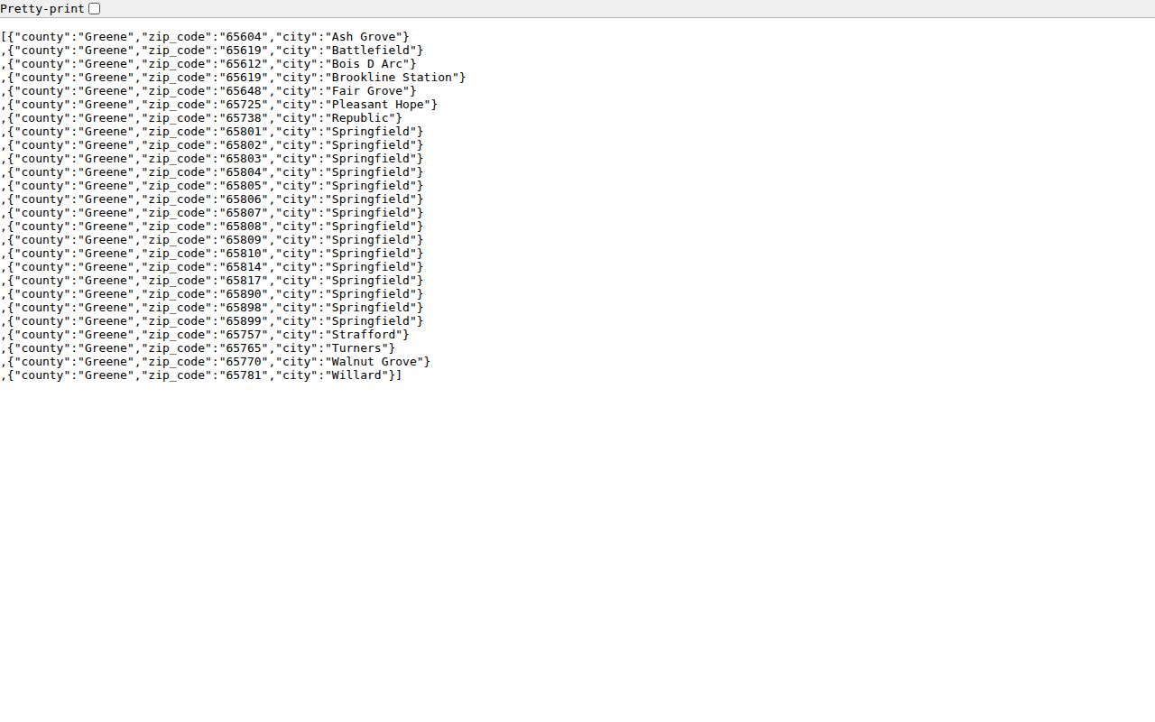
That limited source is still valuable because it shows the county’s overlapping postal labels without pretending those labels resolve property, civic, or residency questions.
Greene County USPS ZIP Code Checks
The USPS postal lookup answers a different question from the state crosswalk. By Address requires company, street, unit, city, state, and ZIP. By City and State requires city and state. USPS also offers a cities-by-ZIP route. Use the complete-address route when a full mailing address is known. A recognized mailing format does not confirm that a particular person or organization is at that address.
The USPS city and state form illustrates the official address-validation route.
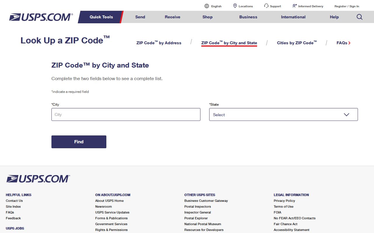
USPS warns that a recognized city name and an actual mailing address can differ. That is why a full address is more useful than a ZIP alone when the task is to validate mail format.
| USPS route | Inputs documented in research | Best use |
|---|---|---|
| By Address | Company, street, unit, city, state, and ZIP | Validate the mailing ZIP for a complete address. |
| By City and State | City and state | Find ZIP possibilities for a named place. |
| Cities by ZIP | ZIP | Check recognized city names associated with a postal code. |
Greene County ZIP Search Routes
A ZIP search can narrow a geographic question, but the documented Greene County systems do not provide a verified ZIP-wide resident search. The Assessor portal visibly offers address, PIN, map, and owner searches. Research did not document a ZIP filter there, so it should not be represented as one. Missouri voter-file law permits some list or request routes by county, township, ward, precinct, or election, subject to its own rules, but no current Greene County downloadable ZIP file or fee schedule was verified.
- Use the state ZIP and city snapshot only to identify a postal label that may be relevant to Greene County.
- Check the known complete address through USPS, or use city and state to identify possible ZIP codes before assuming a postal match.
- For a parcel or jurisdiction question, use the Greene County Assessor advanced map with an address, PIN, map point, or owner lead. Read its city-limit and district layers as separate geographies.
- For election-record access, ask the Greene County Clerk about a lawful, statute-permitted request. Do not treat a voter route as a ZIP-wide resident list.
Once a postal question is narrowed to a real street address, the Greene County by-street directory covers the address-keyed record trail. Postal validation remains only one step, not an identity finding.
Greene County ZIP Boundary Myth
Myth: a mailing city or postal code tells you the city limits, neighborhood, and county office that govern an address. In Greene County, those are separate layers. The Assessor GIS can show lots, subdivisions, school districts, fire districts, and city limits, while Springfield’s neighborhood organization layer maps a civic geography. Neither layer is a postal delivery boundary. A ZIP can overlap named places, and a neighborhood label can cross a postal pattern without any one of those systems being wrong.
Insider tip. Check the mailing format with USPS, then inspect parcel and city-limit layers before deciding which Greene County or municipal office holds the record.
That order avoids sending a request to the wrong custodian. It also keeps a postal directory from turning a mailing label into a claim about who lives within a civic boundary.
Greene County ZIP Boundary Limits
ZIPs are postal delivery tools. City limits are legal municipal boundaries. Census ZCTAs are statistical approximations rather than postal delivery areas. Greene County boundaries, city boundaries, school districts, fire districts, neighborhood polygons, postal routes, and Assessor map layers therefore answer different questions. A mailing address near Ash Grove, Battlefield, Fair Grove, Republic, Strafford, Walnut Grove, Willard, Bois D’Arc, or Brookline Station may need a parcel or city-limit check before a record request is routed.
The Assessor map viewer can help test the parcel and jurisdiction side of that question. It does not establish a legal survey boundary, and a recognized postal address does not confirm a resident, business, or government custodian.
- ZIP versus ZIP+4
- A ZIP is the basic postal code. ZIP+4 adds four digits that can refine delivery sorting for a specific address or delivery segment.
- PO Box ZIP
- A postal code used for post-office boxes. The inspected state snapshot does not classify any Greene County row as a PO Box ZIP.
- Unique-use ZIP
- A postal pattern associated with a single large recipient or special use. The inspected state snapshot does not identify any Greene County row this way.
- Carrier route
- A delivery sequence used by postal operations. It is not a public household list or a municipal boundary.
Greene County ZIP ZCTA Distinction
A Census ZCTA is a statistical approximation used for Census geography. It is not the same thing as a USPS delivery ZIP. That distinction matters when a data table, map, or population figure uses a ZCTA label. The figure should remain labeled as a ZCTA rather than being silently attached to a postal label in the Greene County crosswalk. The inspected Missouri crosswalk records ZIP and city rows, while USPS handles postal-address validation. Neither source turns a ZCTA into a delivery boundary.
Use the geography named by the source. A Census profile can answer a statistical question within its own approximation. A USPS result can check a mailing format. The Assessor’s parcel and map tools can help identify a taxable parcel, city limit, school district, or fire district. These records may overlap at one address, but they do not replace one another and they do not supply a resident list.
Greene County ZIP Data Gaps
The source record has clear limits. No authoritative ZIP-level population figure, ZIP+4 range, post-office schedule, or city-by-city ZIP boundary polygon was located in the research. It is more accurate to say that a ZIP and city row appears in the August 27, 2026 Missouri snapshot than to attach an unsourced neighborhood or delivery description to it. For a single address, the complete USPS lookup and the relevant parcel or municipal record are the better next checks.
Keep a short source note with every ZIP result: the date of the Missouri crosswalk, the date USPS was checked, and whether the remaining question concerns postal delivery, a parcel, a city limit, or a civic neighborhood. That simple separation is especially useful with 65619, because the documented Greene County snapshot pairs that one code with both Battlefield and Brookline Station. A shared postal label is a prompt to verify the exact address, not a conclusion about jurisdiction or a group of residents.
The county and city result is a dated snapshot. Check USPS again when a current mailing format or postal status matters.
Note: A postal code can organize a search, but the date, full address, and correct custodian determine whether a result is useful.