
Trace Greene County Streets by Address
For a Greene County street directory question, begin with the complete address, including any direction, street type, unit, place, and ZIP. The Greene County Assessor is the first official stop because its parcel tools can be searched by address, owner, PIN or map. The result can supply a parcel lead, current owner-of-record detail, and the legal description needed for the next step. It cannot establish that an owner, taxpayer, mailing addressee, and occupant are the same person. Keep those roles separate in every note.
- Search the exact address in the Assessor portal. Save the parcel or PIN, source date, and legal description instead of copying a name into an address list.
- Open the same area in the Assessor map to compare lots, subdivisions, city limits, school or fire districts, and nearby parcel lines.
- Use the legal description, a party name, book/page, or document number in the Recorder index. The Recorder does not offer a street-address deed search.
- For a dated household lead, check the Library’s cross-reference and historical directories. Treat an entry as evidence for that edition, not a current claim.
- If the needed record is closed, unavailable online, or too old for the portal, ask the relevant custodian or the Archives for the named series.
That sequence avoids a common error: treating a street name as if it were one universal search key. The parcel connects land records. A dated directory can connect an address to a historical household. Election tools and postal tools have their own input and privacy rules. Address research works best when each result remains attached to the office that created it.
Greene County Address Searches
The Greene County Assessor portal presents four useful starting paths: address, owner, PIN or real-property number, and map. It also describes assessment history, aerial imagery, and property characteristics. Ownership, sale dates, and characteristics are updated nightly according to the portal, so write down the date checked. The map is informational and is not a legal description. Use the deed or recorded plat when a legal boundary matters.
| Assessor search field | Use for a street search |
|---|---|
| Address | Locate a property record from a complete street address. |
| Owner | Find a property record by owner-of-record name, not a confirmed occupant. |
| PIN / real property | Return to one identified parcel without relying on an address format. |
| Map | Inspect parcel context and available map layers. |
The Public Information Room at the Historic Courthouse is another route. It is in Room 35 at 940 N. Boonville and has public computers and staff assistance. The Assessor says phone search requests are no longer accepted, so use the portal or the public room for a detailed parcel question. The office’s public information includes property address, ownership, districts, acreage, maps, and section-township-range data.
Note: Assessor data can contain errors, so record the parcel identifier and verify a title question with the Recorder’s underlying instrument.
Greene County Parcel Map Layers
The Assessor advanced map adds context to a by-address search. Its tools include measurement, buffers, layers, reports, and print or export controls. A buffer can help inspect the immediate area around a parcel without pretending that nearby parcels share the same civic boundary. Lots and subdivisions, school districts, fire districts, and city limits are distinct layers. None replaces a legal survey or a recorded legal description.
The official Assessor map-tools view shows the available controls in one place.
Use those controls to understand parcel context, then cite the record that answers the actual question.
A Springfield mailing address does not settle municipal jurisdiction. County addressing may apply outside city limits, while city permits and code records follow the City of Springfield’s jurisdiction. The City’s neighborhood polygons are civic geography, not ZIP, parcel, or legal-boundary lines. Match the source to the question before attaching a neighborhood or city label to a Greene County street directory result.
Greene County Recorded Deed Route
The Greene County Recorder real-estate search offers six modes: Document Number, Name, Document Type, Book/Page, Affected Book/Page, and Legal. Street address is not among them. After the Assessor supplies a legal description or owner-of-record lead, search the Recorder with that legal description, a party name, a book/page, or a document number. A recorded instrument can show a grantor, grantee, date, and land description. It is not a current occupancy list.
The Recorder’s search landing page displays the six modes that shape this handoff.
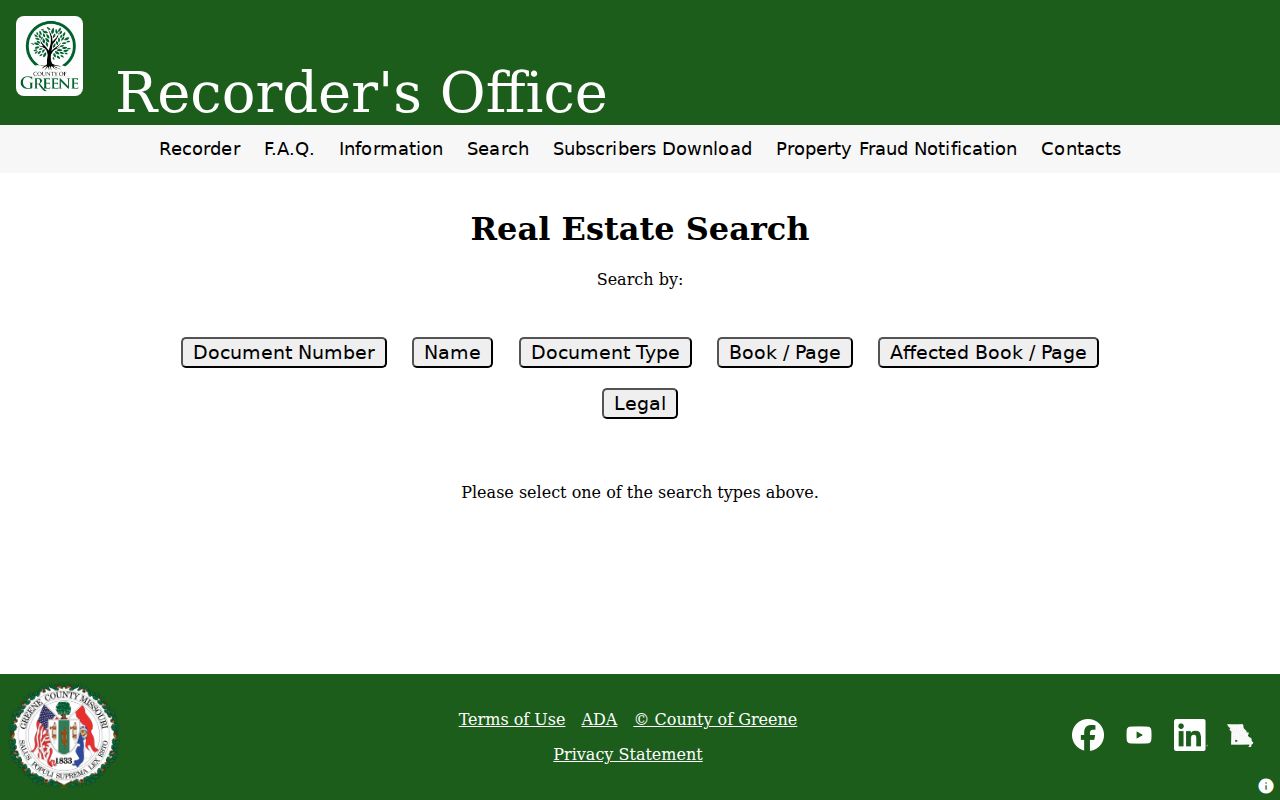
Using the legal or party-based route keeps a street search tied to the index fields the Recorder actually supports.
- Parcel
- A defined piece of real property used in assessment and mapping. Its identifier is a strong bridge between the address and county property records.
- Situs address
- The physical property address. It can differ from the owner’s mailing address and is not a substitute for the legal description.
- Plat
- A recorded map that identifies lots, blocks, or subdivisions. A plat can help place a parcel in its recorded layout.
- Criss-cross directory
- A historical directory organized by address rather than only by surname, useful for a dated household clue.
Greene County Street Records by Address
Several Greene County records can be reached from an address, but each has a narrow purpose. The Assessor owns the full parcel and map view. The Recorder owns recorded instruments and must be searched through its supported fields. The County Clerk is the election authority, while its public election routes are not a general people index. City permit information in Springfield eCity concerns city records and may identify an applicant or authorized agent, not a property owner or occupant.
| Address-keyed record | Official keeper | What it can show | Access route |
|---|---|---|---|
| Parcel and assessment data | Greene County Assessor | Property, owner-of-record, districts, maps, and characteristics | Portal or Public Information Room 35 |
| Map context | Assessor GIS | Lots, subdivisions, city limits, district layers, measurement, and buffers | Advanced map viewer |
| Recorded instruments | Greene County Recorder | Party roles, legal description, book/page, document type, and dates | Six-mode index or Recorder counter |
| Election tools | Greene County Clerk and Missouri SOS | Election-specific address routes and limited statutory voter data | Official lookup or Clerk request |
| City permit record | City of Springfield | Project and inspection workflow within city jurisdiction | Springfield eCity |
For current parcel research, the PIN or legal description is usually more stable than a street string. For older address research, retain the source’s spelling, place name, and date. The Recorder cannot conduct lien searches for a requester, and a Collector tax receipt is not a deed or proof of title. These limits keep an address result from claiming more than the record says.
Greene County Street History
Historic street work needs dated sources. The Springfield-Greene County Library digital city-directory collection makes 1901 through 1920 volumes available where copyright permits, and some volumes provide both surname and street or dwelling-number indexes. The library also holds cross-reference directories from 1950 through 1970 on microfilm and later runs in closed storage. A street-index entry is useful for an address snapshot, not for asserting a present resident.
The 1878 Escott directory includes an explanation of street numbering. It gives a period baseline for an old address, but the research did not locate a documented countywide street-renumbering event. Do not manufacture one. Compare the old directory, the 1908 map, Sanborn maps, a plat, and the current parcel map before deciding that two differently written addresses are the same place. The Library holds Springfield Sanborn maps for 1933 through 1950 and a 1957 print version.
A historical household question belongs with the Greene County city directories, where the editions and reading methods are treated in depth. For a street-level search, use only the dated address evidence needed to connect the parcel trail.
Note: Preserve original street names and place labels because North Springfield and other historical descriptions may not match current mailing conventions.
Greene County Address Rules
A precise address search uses separate parts: number, directional prefix or suffix, street name, street type, unit, city or place, state, ZIP, and parcel or PIN when available. Preserve the source spelling as well. The USPS ZIP lookup has distinct address, city-and-state, and cities-by-ZIP modes. Its by-address form accepts street address, optional unit, city, state, and ZIP, then returns recognized mailing information.
Recognition by USPS verifies a mailing format, not a person’s presence. Greene County election tools also have a portal-specific rule: the absentee status route asks for house number and street name without the street type. That is an input instruction, not evidence that the underlying address omits its suffix. Use current election pages for live tools and do not save identifiers submitted to an election form.
Greene County Street Directory Privacy Limits
A street directory cannot reliably show every household member, private occupant, mail recipient, or recent move. Assessor data generally concerns the parcel owner or mailing address. A deed records a legal transaction. Voter information is controlled by RSMo 115.157 and the election system’s access rules. Driver address data is restricted under the federal Driver’s Privacy Protection Act, and utility customer details may be protected under Missouri public-record exemptions.
Safe at Home, voter-address closure, and court protective orders can intentionally suppress an address. Treat “not displayed” as a possible protective result, not a gap to reconstruct through adjacent records. If a record is needed from a county office, a focused Missouri Sunshine Law request should identify the record series, date range, custodian, and preferred format rather than asking for every record about a person.
Lawful use. Greene County address records support personal, lawful research and house history. Do not use them to stalk, harass, intimidate, or locate someone whose address is protected.
Greene County Street Directory Myth Check
A street address is a useful parcel lead, not a substitute for a title search. The Recorder’s free Property Fraud Notification service is another useful record-trail tool: it emails subscribers when documents matching selected criteria are recorded. It is an alert, not a prevention or title-insurance service. A notification signals that the recorded document should be checked with the Recorder, using its document details and the current fee information where a copy is needed.
The Recorder’s FAQ makes the address limitation visible before a search begins.
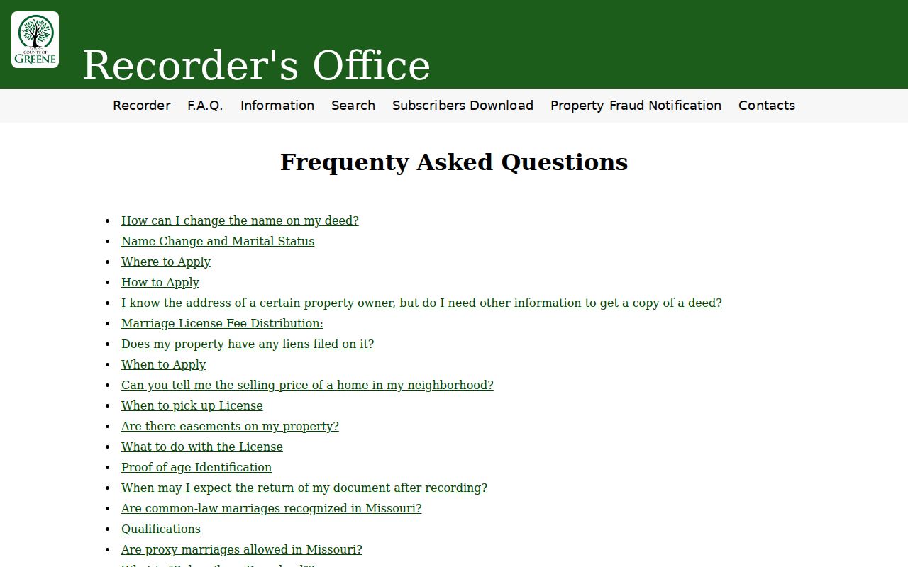
That limitation is a useful safeguard against confusing a street directory lead with a complete title record.
Greene County Street Directory Dead Ends
When the portal does not return a result, check the address format, direction, street type, municipality or place, and ZIP. Then search the Assessor by map or PIN if one is known. The Recorder’s detail pages triggered human verification during research, so an online dead end can require the Recorder counter or a specific request. For historical material, the Greene County Archives holds older court, probate, assessor, Recorder, and related county series and accepts an online contact request.
Record a result as “not located” when the right custodian and search field have been tried. That is more reliable than guessing from a matching street name. Greene County was organized in 1833, and the 1861 courthouse fire means the surviving series and Archives finding aids, rather than a promise of complete early records, should guide older street research.